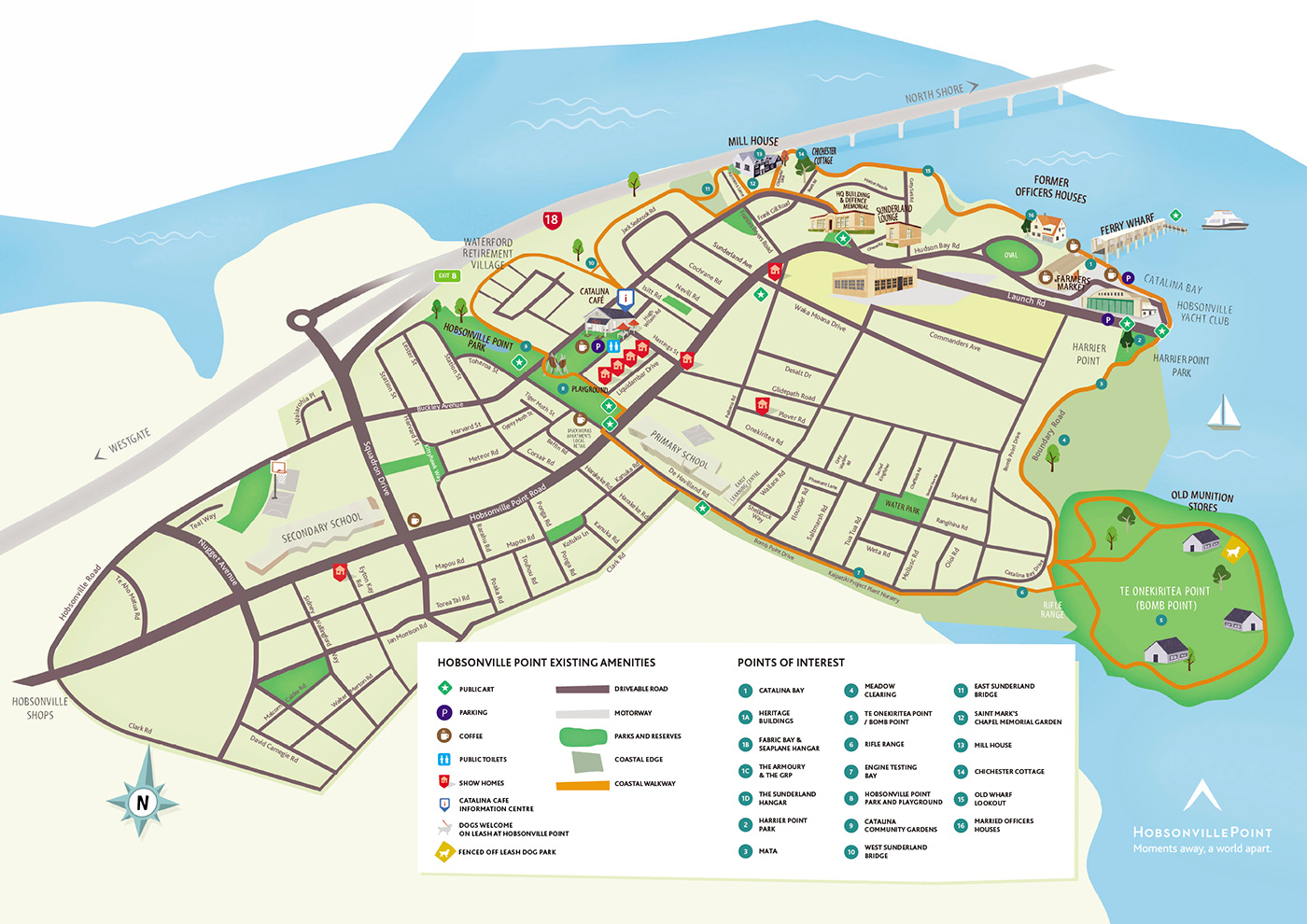
Download the map
 Download


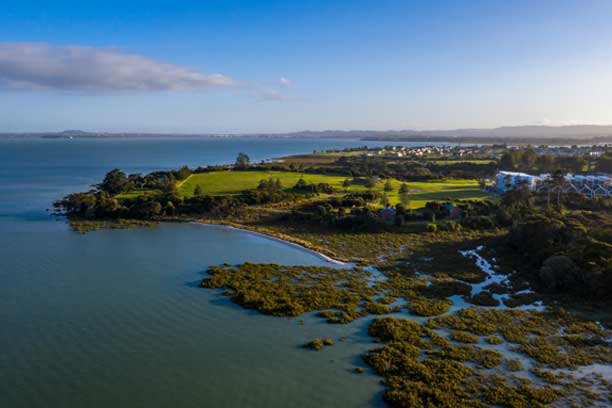
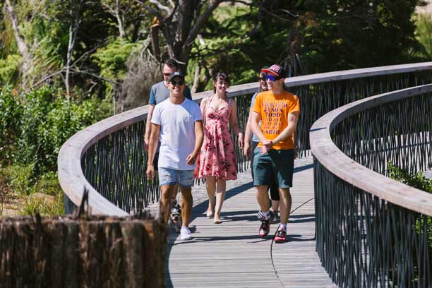
Our amazing coastal walkway is a 5km, almost flat, looping track that hugs the peninsula’s shoreline and then cuts across the township from coast to coast. It passes through several neighbourhoods as well as the bustling waterfront at Catalina Bay and peaceful bush-clad gullies. With opportunities for rest and relaxation, play and picnics, history and harbourside views, it delivers an experience that is unique to this place. Download your map here, grab your walking shoes or your wheels and do the loop.
The walk is 5km of flat, easy terrain. You can choose to do the whole loop, or just part of it. There are points of interest the whole way round.
Absolutely! The walk connects a number of parks, including Harrier Point playground on Launch Road (featuring a giant bucket swing and flying fox overlooking the water), and the award-winning Hobsonville Point playground on Buckley Avenue. The walk is pram, cycle and scooter-friendly for little ones.
Sure thing. Just remember your leash - there are some important bird breeding grounds along the walkway. There is an off-leash dog park at Te Onekiritea Point (Bomb Point).
Yes, but please keep left, give way to pedestrians and be respectful of other walkway users at all times.
Yes. Some of the walkway is boardwalk, some footpath, and the rest is reasonably flat, graded gravel. There are disabled parking and toilets at Catalina Bay.
There are public toilets at the Farmers Market at Catalina Bay and at the Information Centre on Hastings Street (behind Catalina Café on Buckley Avenue).
The name Te Ara Manawa has been gifted from local mana whenua, Te Kawerau a Maki and Ngāti Whātua o Kaipara. Te Ara Manawa means “the pathway amongst the mangroves” while manawa also refers, in poetic terms, to the heart or seat of human emotions. ‘Onekiritea’ is the traditional name for Hobsonville Point and the kainga (Māori village) once located here. It also refers to the white clays sourced on the peninsula, which Māori had several traditional uses for.
The following points of interest are ordered in a clockwise direction.
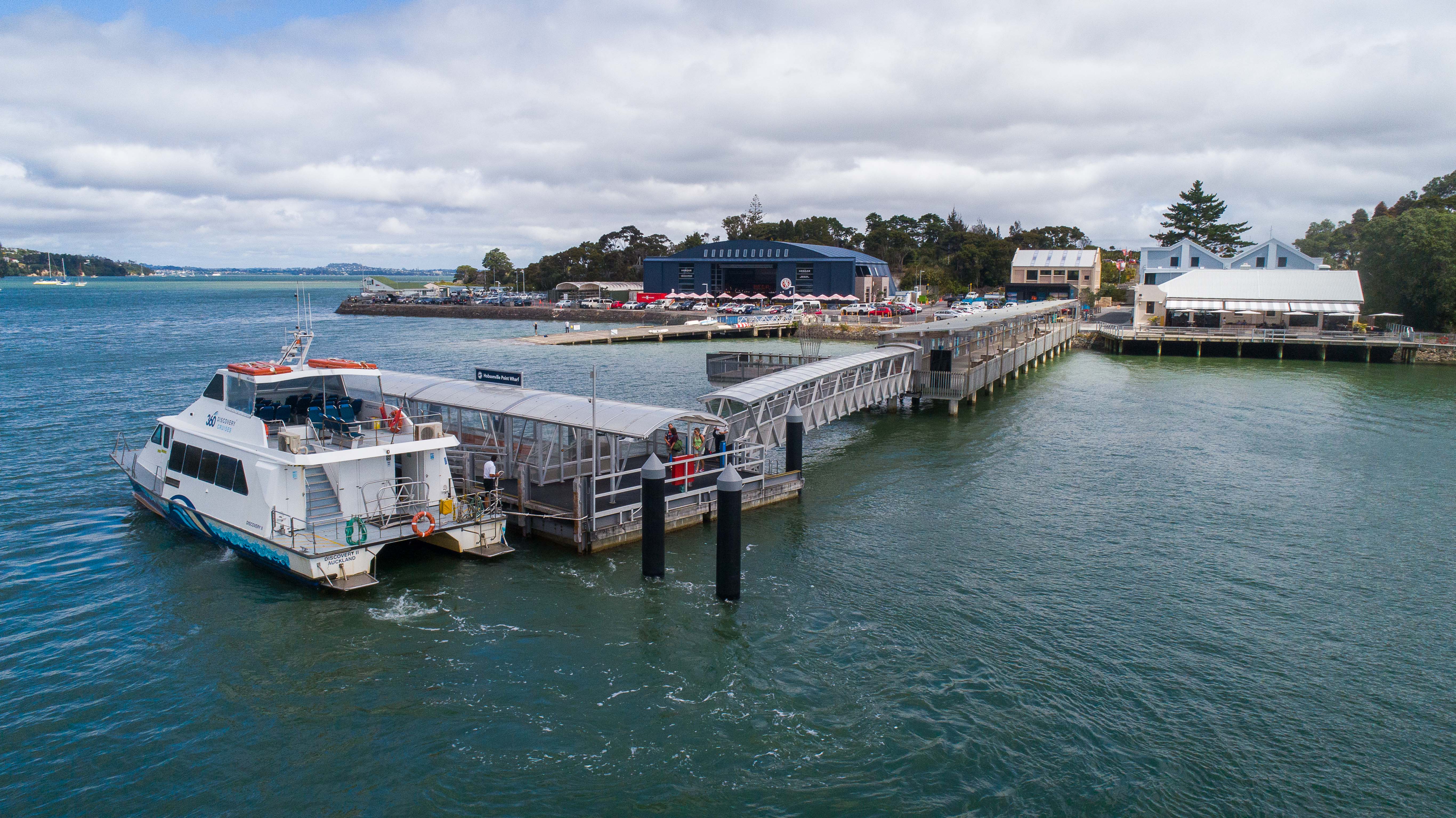
This 1.8 hectare area of waterfront land is known as Catalina Bay. It is set to become a new precinct which will provide a social hub for the Hobsonville Point community and an exciting new destination for Aucklanders to visit on the weekends.
Catalina Bay has been masterminded by Willis Bond & Co with the help of Cheshire Architects and will feature shops, office space and homes alongside fun, friendly places to eat and drink, including a Little Creatures microbrewery expected to open early 2019.
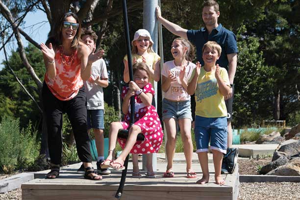
Climb the stairs at the bottom of Launch Road to find Harrier Point Park with its gorgeous harbour views, flying fox and basket swing for the kids. There’s also picnic tables and barbecues. Soon Harrier Point Park will become home to a giant interactive play sculpture, The Eye of the Bird by artist Philipp Meier, which you’ll be able to climb up inside. The 10-metre-tall pied shag, will offer a bird’s-eye view from a viewing platform in its head and a slide that pops out at its tail. Harrier Point Park was formerly the location of the Base Commander’s house (since relocated to the corner of Sunderland and Buckley Avenues).
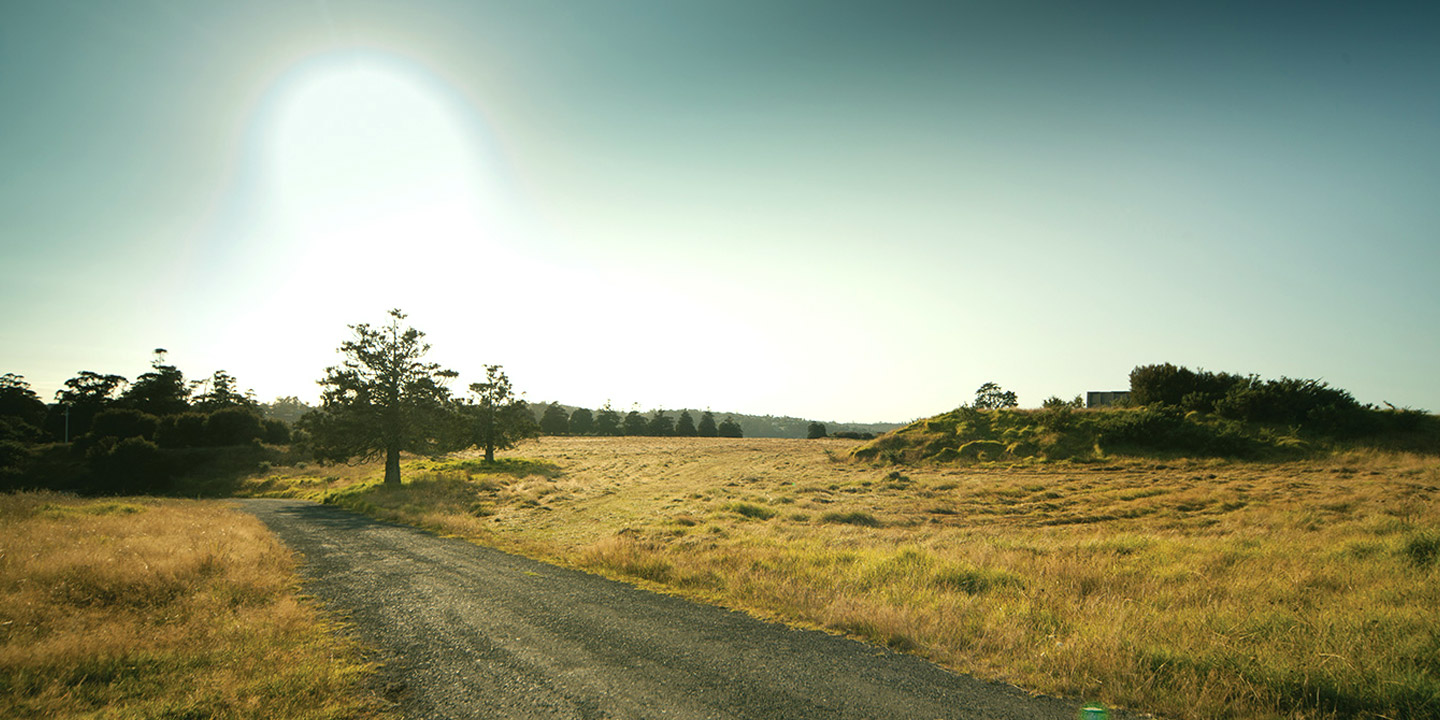
Thirteen perfectly uniform brick buildings tucked away behind tunnels punctuate the perimeter of Te Onekiritea, once the site of New Zealand’s largest Air Force explosives depot. The area is now officially known as Te Onekiritea Point following a Treaty of Waitangi settlement with Te Kawerau a Maki. The name speaks to the area’s history as the site of a kāinga (Maori village) and the source of the white clay, which Māori used for pigments. Te Onekiritea Point is public, open space, complete with a fenced dog park.
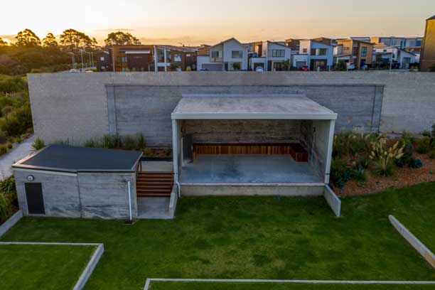
Bullet holes scattered across the stage backdrop hint at the history of this repurposed rifle range. This facility served as a machine gun range for Air Force personnel, the SAS, Navy and the Diplomatic Protection Squad. The range, which was completed in 1940, was the place where many New Zealand men came to learn about weapons and practice shooting at cardboard targets. The Rifle Range is an amphitheatre for residents and visitors to Hobsonville Point.
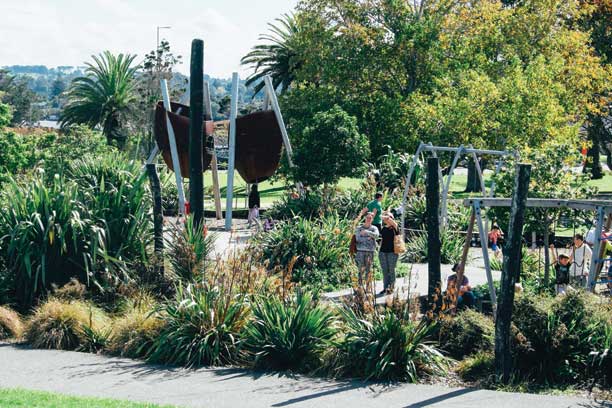
Hobsonville Point’s first park straddles Buckley Avenue. The eastern end is home to the Hobsonville Point Park playground, where the kids can clamber up, over and through giant, sculptural seed pods fashioned out of steel. Walk westward from Buckley Avenue toward the coast and you’ll see John Reynolds sculpture, Tiwatiwata, a series of blackened tree trunks marching across the land.
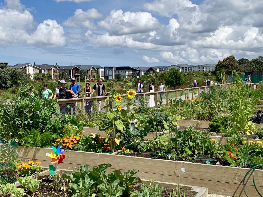
Hobsonville Point’s community garden gives residents a place to indulge their love of gardening, share information and resources, and meet and get to know their neighbours. The garden includes 29 plots, a composting area and a communal herb bed and fruit trees. The garden has been funded by Waterford on Hobsonville Point, the Upper Harbour Local Board and HLC.
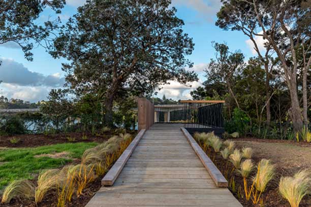
The Sunderland bridges have been designed to raise users above the ground to enjoy the experience of being in the treetops amongst the birdlife. The West Sunderland bridge is 35m long. From the middle of the bridge you can see Herald Island. The East Sunderland bridge is 98m long and offers views of Te Okoriki Inlet with its mature pohutakawa trees.
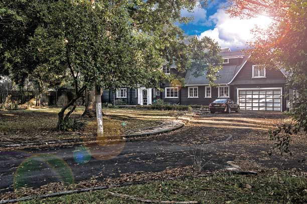
One of Hobsonville Point’s oldest homes has been renovated and will open as a Bear Park childcare centre. Construction of the distinctive homestead began in 1929 for pioneer aviators, Doug and Audrey Mill. In 1941 the homestead was incorporated into the neighbouring Air Force base. Surrounding land was used for Air Force housing while the house itself became part of the Hobsonville Officers Mess.
Take a small detour off the walkway and be rewarded with harbour views from the Old Wharf Lookout. The lookout is cantilevered over the cliff edge and offers a great view of the harbour. It sits above the site of Hobsonville Point’s old wharf. While the original structure has gone, the approach to the lookout is marked with a row of timber posts, recalling the old jetty’s skeletal form.
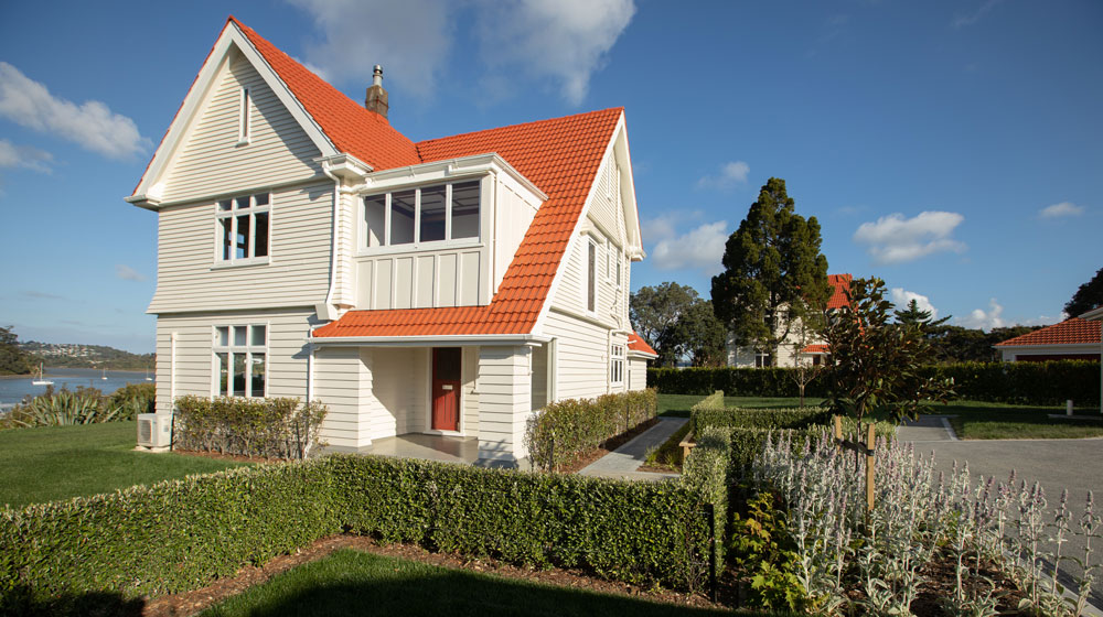
The four, elegant old houses with orange tiled roofs above the cliff edge were built to house officers and their families on the base. The homes have been restored by Winton as part of their development of Launch Bay. They back onto Marlborough Oval, which was once the Air Force’s formal parade ground.
